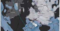
As spring unfolds in the UK, a dramatic weather shift is on the horizon, with forecasts predicting snow to blanket much of the country in mid-April. The Met Office recently declared March 2025 as the sunniest on record in England, but this sunny spell is set to give way to a wintry blast. Weather maps generated by WXCharts indicate that on Thursday, April 17, a significant snow barrage could hit England, Wales, and Scotland, covering large parts of the nation.
According to WXCharts, snow is expected to begin falling at midday on April 17, with much of the UK shaded in white on their maps, indicating snow-covered regions. Only five counties are predicted to escape the snow: Cornwall and Merseyside in England, South Glamorgan and Gwent in Wales, and Renfrewshire in Scotland. The forecasters suggest that temperatures could plunge as low as -3°C in some areas, particularly in Scotland, while other regions may experience even colder conditions.
In the days leading up to this predicted snow, temperatures in the UK have already begun to fluctuate significantly. After basking in temperatures as high as 19°C during a mini heatwave, the mercury is expected to drop dramatically, potentially reaching lows of -8°C by April 18, which coincides with Good Friday this year. Such a shift in temperatures is likely to cause significant snowfall, especially in northern England and parts of Wales.
Weather experts at Metdesk, which provides data for WXCharts, predict that by the afternoon of April 16, snow will blanket most of the UK, with some areas experiencing snowfall rates of up to 6cm per hour. The heaviest snowfall is anticipated in Cumbria, Northumberland, and Durham, with snow expected to continue into the following days. By 6pm on April 17, snow will likely remain across the Midlands, the north, and the eastern fringes of England.
Despite these forecasts, the Met Office has issued its own long-range weather outlook, which presents a somewhat different scenario. Their forecast for the period from April 6 to April 15 indicates that high pressure will dominate, resulting in largely settled conditions and prolonged dry weather. While they acknowledge the possibility of cooler spells and overnight frosts, they do not predict significant snowfall during this period. Instead, they suggest that while rain or showers may move in from the west, widespread heavy snow is not anticipated.
In contrast, reports from The Mirror have raised alarms about potential snowfall from April 12 to April 14, predicting significant accumulations in central and southern Scotland, as well as northern and eastern England, including London. These reports suggest that temperatures could drop to around 0°C, supporting the possibility of snowfall across a broad area. However, the Met Office continues to maintain a more conservative outlook, emphasizing the likelihood of dry and bright weather for much of the period.
As the weather continues to shift, the public is advised to remain vigilant and prepared for changing conditions. With the potential for snow, especially in the northern regions, it’s essential for residents to stay informed through reliable weather updates. The contrasting forecasts highlight the unpredictable nature of British weather, where a sunny day can quickly turn into a winter wonderland.
Looking ahead, the Met Office's long-range forecast for late April suggests a return to high pressure, which may bring mainly dry and fine weather as the month progresses. However, this will depend on the prevailing weather patterns, which are currently showing signs of instability.
In summary, while the UK has enjoyed a bright start to April, the approaching snowstorm is a stark reminder of the volatility of spring weather. As temperatures plummet and snow begins to fall, it’s a fitting example of the UK's notorious weather unpredictability. Residents are urged to prepare for the upcoming changes and to monitor forecasts closely as the situation develops.


