Residents of Columbus and Cincinnati are savoring unseasonably warm weather, but forecasts predict significant changes as severe storms are likely to hit just days before the weekend. The National Weather Service (NWS) has confirmed favorable conditions through midweek, creating the perfect opportunity for locals to enjoy mild temperatures before bracing for looming inclement weather.
According to the latest NWS forecasts, Monday evening to Tuesday, March 18, 2025, is set to bring clear skies and temperatures expected to soar to nearly 70 degrees. The warm conditions are indicative of what can be achieved at this time of year, with Tuesday highs forecasted to reach around the 70-degree mark, presenting ideal conditions for outdoor activities.
"Forecast highs on Tuesday will reach the 60s area-wide," the NWS notes, encouraging residents to take advantage of the pleasant weather. Nevertheless, this comfort won't last long, as predictions signal the arrival of a cold front on Wednesday.
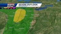
By midday Wednesday, temperatures will begin to drop, with rain showers on the horizon as the system approaches. "Expect gusty winds of 30 to 40 mph from Wednesday through Thursday," warns the NWS, ushering concerns about how outdoor plans and driving conditions will be impacted as storms could bring rain and possibly thunder by late Wednesday night, coinciding with the Xavier game tipping off at 9 P.M..
By Thursday morning, March 20, 2025, temperatures are expected to plummet—dropping nearly 20 degrees from Wednesday highs. Weather forecasts show it will be around 40 degrees with continued gusty winds. There's speculation of either cold rain or flurries of wet snowflakes, adding to the unpredictability of seasonal transitions.
For frequent travelers and pilots, potential turbulence and wind advisories may complicate travel plans. An advisory is already in place due to wind gusts anticipated to exceed 35 knots late Wednesday night through Thursday, pressing all travelers to prepare accordingly.
Despite the threat of adverse weather on Thursday, the NWS suggests conditions will improve by Friday, with drier air ushering clearer skies as the rain system moves east. "We should see clearer skies by Friday," suggests meteorologists, offering hope for respite.
But that's not the end of it. Another weather front could bring intermittent rain on Saturday, March 22, 2025, leading to more unpredictable early spring climate, with stormy conditions likely re-emerging by nighttime on Sunday, March 23, 2025.
This weather rollercoaster presents both advantages and drawbacks for residents. Some individuals have expressed their preference for snow over bitter, cold rain—especially considering temperatures oscillate drastically more than average. One local remarked, "I'd prefer the snow than miserable cold rain, you know what I mean?" indicating the mixed feelings of residents anticipating the changing forecast.
Regardless of personal preferences, those making outdoor plans will need to stay vigilant and monitor the shifting forecasts. With the unpredictable winter-to-spring shift at play, locals must prepare for everything from sunny skies to snowy flurries and gusty winds. These rapid changes tell the story of springtime weather, reminding us of its fickle nature and necessitating flexibility.
Looking forward, as City residents prepare to spend time outdoors Tuesday, they should also stay informed on the impending shift—a reminder to keep those umbrellas handy starting Wednesday evenings!