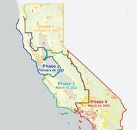
The California State Fire Marshal's Office (OSFM) has unveiled a new map detailing fire hazard severity zones across California, a critical update that will take effect starting April 1, 2025. This is the first update to the map in 14 years, which is designed to aid both state and local governments in developing effective fire prevention and emergency response strategies.
The significance of this updated map cannot be understated, as California continues to grapple with increasing wildfire risks exacerbated by climate change. Governor Gavin Newsom initiated this update following a devastating wildfire in January 2025, which underscored the dire need for more precise risk assessment tools in the face of ever-growing fire threats.
The new fire hazard levels on the map are classified into three distinct categories: moderate, high, and very high. These classifications are determined by a range of factors including topography, fire weather conditions, flame length, historical wildfire occurrences, vegetation types, and the probability of fire occurrences. Each fire hazard level is visually represented in a gradient of colors—yellow for moderate, orange for high, and red for very high—allowing residents and officials to quickly identify regions at heightened risk.
In the Los Angeles area, for instance, several regions have been marked with very high fire hazard levels. These areas include the hillsides stretching from Pershing Peak to Griffith Park, as well as various interface zones where communities meet wilderness areas, notably in Glendale, La Cañada, Crescenta Valley, and near the Angeles National Forest. Areas such as Palos Verdes, Malibu, and La Habra Heights have also been designated as very high-risk, signaling to residents the urgent need for preparedness.
The map provides a comprehensive overview enabling communities to strategize effectively against wildfires. As the risk of wildfires is projected to surge in the coming years, local governments will utilize this updated information not only for immediate response tactics but also for long-term planning and investment towards mitigation strategies.
The OSFM emphasizes that the new map will facilitate better outreach and education efforts for communities most at risk. This proactive approach aims to ensure that residents are well-informed about the fire dangers in their area and equipped with the necessary resources to prepare adequately.
Alongside this release, experts from the OSFM are advocating for community engagement and collaboration in fire safety efforts. They are urging residents to take personal responsibility for fire safety by creating defensible space around their homes, preparing emergency kits, and developing evacuation plans in light of heightened fire risks.
“The launch of this updated map is timely and critical as we face the reality of escalating wildfire threats,” said a spokesperson for the OSFM. “Our hope is that communities will use this resource to prepare and protect their families, homes, and the environment.”
Residents can access this invaluable resource and view the detailed fire hazard severity zones on the California State Fire Marshal's Office website at osfm.fire.ca.gov. With the ongoing challenge of wildfires, this comprehensive map represents a significant step forward in equipping communities to face the wildfire threats ahead.
The updated fire hazard severity zones map will not only serve as a tool for current fire management strategies but aims to foster greater awareness and resilience among California residents in their ongoing fight against wildfires. As the state transitions into yet another fire season, the commitment to comprehensive preventative measures becomes crucial.
This map symbolizes a commitment from the state to protect its residents amidst an environment increasingly characterized by volatile weather patterns that contribute to catastrophic wildfires.