A significant tropical weather system is currently affecting areas of Australia, including the Cocos (Keeling) Islands and providing dangerous rainfall conditions across Far North Queensland. As of March 19, 2025, the Bureau of Meteorology (BoM) reported that Tropical Low 25U is strengthening into a cyclone as it tracks southward, expecting to bring strong winds and squally showers to these islands.
According to senior meteorologist Miriam Bradbury, the cyclone will not impact the Australian mainland directly because it remains too far offshore. "But it will bring strong winds and squally showers to the Cocos Islands," Bradbury explained, predicting that the cyclone will slowly move further south, eventually weakening by the end of March 20.
In addition to this, another weather system identified as Tropical Low 27U is forming off the north-west Kimberley coast, with a low chance of developing into a cyclone from Friday, March 21, into the weekend. Although it is forecast to stay offshore, the BoM warned that it could still bring increased rainfall to the Pilbara region.
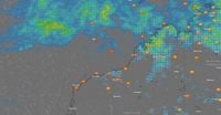
Meanwhile, communities in Far North Queensland are bracing for more heavy rainfall. Townsville, Ingham, and Ayr have reported significant downpours, with the BoM indicating that six-hourly rainfall totals could reach between 120mm to 160mm, with isolated areas even registering up to 240mm. These torrential rains have already led to flash flooding in several parts of the region.
In fact, Townsville has recorded an unprecedented 301.4mm of rain in just 24 hours—marking the highest daily total in 27 years. Between 1 am and 9 am, the region alone received 241.4mm, which substantially contributed to widespread flooding, pushing many roads under water.
Horseshoe Bay on Magnetic Island also faced exceptional rainfall, tallying 351mm in that same timeframe. Earlier in the year, Townsville had already faced flood conditions, experiencing 710mm of rain in 72 hours during a rare one-in-2000-year event.
Given these conditions, the BoM has issued flood warnings for multiple rivers across Queensland. Although the Herbert River at Halifax has dropped below the minor flood level of 4.00 meters, the Haughton River and Upper Burdekin Catchment still face possible minor to moderate flooding. Other catchments at risk include the Murray River and the Black, Ross, and Bohle Rivers.
As these severe weather events unfold, roads across Townsville remain blocked due to submersion, leading to numerous State Emergency Service (SES) call-outs for assistance with water inundation and sandbagging efforts. Crews have performed swiftwater rescues, including saving a vehicle caught in floodwaters near Helens Hill on the Bruce Highway. Additionally, local reports indicate minor rockfalls occurred in Belgian Gardens and Castle Hill as conditions worsened.
After being cut off, the Bruce Highway reopened at 2 pm following receding floodwaters, providing some relief to residents. Nonetheless, towns like Ingham are still on alert, having previously suffered significantly from flooding that affected 180 properties back in February. Ingham Mayor Ramon Jayo expressed optimism about the current forecasts, stating, "There is no expectation, based on the current forecast, for any houses or properties to be inundated at all." Weather conditions are set to improve as the trough system decreases in strength by late Wednesday.
Looking ahead, meteorologists remain vigilant regarding cyclone activity in the region. The Madden-Julian Oscillation (MJO) is reported to be intensifying monsoonal winds, further increasing the risk of cyclone developments. The BoM has forecasted that another tropical low is likely to form off the Western Australian coast by March 20, with a 15% chance of this system developing into a cyclone by March 21.
While northern Australia is grappling with these severe weather conditions, Perth is experiencing a different scenario altogether, with sunny skies and high temperatures expected over the next several days—soaring to 35°C on Saturday.
Authorities have strongly urged residents in all affected areas to remain vigilant and stay updated for further weather warnings. Communities are advised to monitor flood alerts and cyclone advisories closely as conditions continue to evolve.