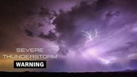
Severe weather swept across Wisconsin on April 28, 2025, prompting multiple tornado warnings and the confirmation of a tornado touchdown in Eau Claire County. The National Weather Service (NWS) issued a tornado warning for western Marathon and northwestern Wood counties until 9:30 p.m., as severe thunderstorms capable of producing tornadoes were detected along a line stretching from Dorchester to near Colby and Loyal, moving east at 55 miles per hour.
Radar indicated rotations in the storm system and hail measuring 0.75 inches. The NWS warned that the storms would reach Marshfield around 9:10 p.m., Wausau at 9:25 p.m., and Rib Mountain at 9:30 p.m. Other areas impacted included Edgar, Rozellville, Big Eau Pleine County Park, Cherokee, Moon, Little Chicago, Stratford, March Rapids, Hamburg, and Poniatowski.
As the storms progressed, the NWS advised residents in the affected areas to take cover in basements or interior rooms on the lowest levels of sturdy buildings and to avoid windows. "Tornadoes are difficult to see and confirm at night," the NWS cautioned, urging people not to wait until they hear or see a tornado to seek shelter.
In addition to the warnings in Marathon and Wood counties, a tornado warning was also issued for parts of Langlade, Menominee, and Oconto counties during the 10 p.m. hour. This warning expired at 10:45 p.m. after a damaging storm swept through the state, including a tornado that touched down in Eau Claire County. Reports indicated that penny-sized hail and wind gusts of up to 60 miles per hour accompanied the severe thunderstorms.
At 11:04 p.m., the NWS reported severe thunderstorms located along a line extending from 8 miles east of Pembine to near Crivitz, moving northeast at 65 miles per hour. The storms posed hazards of 60 mph wind gusts and penny-sized hail, with potential damage to roofs, siding, and trees.
The tornado that touched down near Augusta, Wisconsin, was confirmed by radar at 8:13 p.m. The storm moved northeast at 50 mph, with flying debris expected. The NWS warned of damage to roofs, windows, and vehicles, as well as likely tree damage. By 11:10 p.m., about 80 customers in the Eau Claire area were reported without power, down from 200 earlier that evening.
As the storm system moved eastward across northern Wisconsin, tornado warnings were issued in various counties until 10:45 p.m. The NWS planned to assess the damage on April 29, with crews dispatched to evaluate the impact across the state. Damage reports were expected by mid-afternoon on Tuesday.
In response to the severe weather, the School District of Spencer opened the Spencer Dome as a tornado safe shelter for residents. The dome, located at Spencer High School on North School Street, was prepared to accommodate those seeking refuge from the storms. Residents were encouraged to enter through Door 12 on the north side of the dome and proceed to the fitness center, where members of the Spencer Police or Fire Departments would assist. Indoor pets were permitted on a leash or in a cage at the discretion of the safe room supervisor.
As the weather system continued to develop, much of northern and central Wisconsin remained under a tornado watch until 2 a.m. on April 29. The NWS had issued multiple warnings throughout the evening, emphasizing the importance of preparedness and safety during severe weather events.
For those in areas affected by tornado warnings, the NWS recommends staying as low as possible, ideally in a basement or on the lowest floor of a sturdy building, and putting as many walls as possible between yourself and the outside. Avoiding windows is crucial, as flying debris can pose significant risks during tornado events.
If caught in a vehicle during a tornado warning, the NWS advises against trying to outrun the tornado. Instead, drivers should seek refuge in a sturdy building or, as a last resort, lie flat in the nearest depression, ditch, or culvert, covering their heads with their arms.
With the potential for severe weather continuing, residents are reminded to stay alert and be prepared for sudden changes in weather conditions. The NWS encourages everyone to have a plan in place and to be ready to act quickly should a tornado warning be issued.
This severe weather event highlights the importance of community preparedness and the need for residents to stay informed through reliable weather sources.