The remnants of storm Martinho, which impacted Spain and Portugal, are predicted to significantly affect France over the weekend, especially with strong winds in the southern regions.
Météo France has placed the Haute-Garonne and Tarn departments on orange alert due to the risk of violent winds. Strong gusts exceeding 120 km/h are anticipated as the storm system moves through the country between Friday, March 21, and Sunday, March 23, 2025.
According to a bulletin from Météo France issued at 16:00 on Thursday, March 20, 2025, approximately thirty other departments are under yellow alert, primarily for strong winds—twenty-four departments—along with several others on alert for thunderstorms and potential flooding.
The departments under alert include Allier (wind), Alpes-de-Haute-Provence (storms), Hautes-Alpes (storms), Alpes-Maritimes (storms and wave-submersion), and more, with specific emphasis on areas bracing for the stormy conditions.
Météo France identified that an unstable front would approach western France on Friday. As meteorologist Yann Amice detailed, it is expected that storms will develop over the western regions, beginning on the night of Thursday, March 20. These storms are forecasted to advance towards the east throughout Friday and cover much of France by Saturday, March 22, 2025.
"In the presence of air that is quite warm at ground level but increasingly cool at altitude, thunderstorms are likely to occur," Amice elaborated. As a warning continues, Bouches-du-Rhône, Vaucluse, and Var also remain on yellow alert for storms and high winds, with the latter two facing a yellow alert for wave-submersion.
As wind gusts from the Autan wind are forecasted to peak early Friday morning, residents in Haute-Garonne and Tarn should expect severe conditions. Météo France has advised all citizens to remain alert, particularly between midnight and 15:00 on Friday. The service warns that power outages and structural damage could form as a consequence of these high winds.
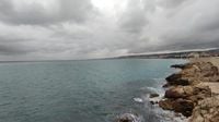
In Nice, authorities announced a closure of beaches, coastal paths, parks, gardens, and cemeteries on March 21 due to these dangerous weather conditions. Mayor Christian Estrosi confirmed that closures will start at 6:00 AM on March 21, urging the public to be cautious as winds gust up to 85 km/h are expected from 8:00 AM that day.
“The conditions may pose a danger to the population and coastal infrastructure,” Estrosi stated. The municipality will actively monitor the situation and is prepared to intervene as necessary, with emphasis on safeguarding residents and visitors from hazardous weather.
As the weather conditions change, residents are advised not to approach the coast or estuaries and to prepare an emergency kit.
Météo France’s latest warnings signal that the intense winds will transition to heavy rains throughout the southern regions of France. As the storm system moves in, rainfall combined with thunderstorms is projected to bring about significant disruption, particularly to the Cévennes and part of the Hérault region.
This winter has already shown variations in weather, with trends indicating shifting seasonal patterns across France. In light of these predictions, officials warn everyone to remain cautious and watch for updates closely.
The severe weather forecast for March 21 through 23 highlights the severe conditions expected for the southern and western parts of France. An unstable atmospheric front may cause continuous thunderstorms, making it imperative for the public to stay informed and safe.
Residents should expect worsening conditions, particularly as more rain and storms develop over the weekend. Conditions will bring varying temperature shifts from warm in the east to colder as the weather moves through from the south and west.
Authorities remind citizens that although the presence of storms and winds is looming, preparedness and caution are keys to staying safe during these tumultuous weather events.
As the impact of storm Martinho becomes more apparent, the importance of adhering to safety alarms cannot be overstated, especially as we head into a potentially hazardous weekend. Keep informed through reliable sources and follow local guidance to remain secure amidst this eventful time.