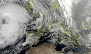
Storm Eowyn has struck Ireland and Northern Ireland with unprecedented force, leading to widespread disruption and severe weather warnings across the region. Starting early on Friday, January 24, 2025, the storm has been dubbed a "bomb meteorological" event due to its rapid formation and escalation of destructive weather conditions.
According to various meteorological reports, Ireland faced record gusts of up to 183 kilometers per hour, particularly near Galway on the west coast. The storms have been so severe, they have prompted emergency coordination chief Keith Leonard to warn, "This will be a dangerous, destructive weather event causing damage." Such high winds are reminiscent of hurricane conditions and have resulted in more than 560,000 households losing power as of Friday morning. The state-owned electricity operator ESB reported extensive and unprecedented damage to infrastructure, directly impacting countless customers.
On the ground, the chaotic scene was exacerbated by the cancellation of flights at major airports, including Dublin, where over 100 outbound and inbound flights were scrapped. Many transportation services have come to a standstill, as public transport ground to a halt, with schools and universities also closed.
The tempest has invoked heightened alert levels across the UK, transitioning from yellow to red alerts. Ireland has been entirely placed on red alert, the first such occurrence since the introduction of the alert system. Walks were struck and it became clear this storm was among the most formidable challenges the region has faced. Paul Gundersen, chief meteorologist at the Met Office, remarked on the significance of the high alert, indicating it is reserved for severe weather events capable of life-endangering conditions and major disruption.
Northern Ireland is currently enduring this extreme weather, with cautionary measures leveraged by both local and area authorities. The rain accompanying the strong winds has been predicted to result in considerable flooding risks involving local rivers and structures vulnerable to water overflow. Forecasting for the region displayed expectations of the storm's intensifying impact across the entirety of the country during Friday afternoon.
Following its path through the British Isles, Eowyn is edged to strike Scotland, presenting substantial threats with forecasted gusts reaching up to 150 kilometers per hour. The Royal Scots are already preparing for severe disruptions, with significant travel cancellations expected both by rail and road. Emergency services have highlighted concerns about infrastructure vulnerabilities, urging residents to remain cautious and moored.
Amid these fierce winds and rain, France is bracing for the storm’s arrival but with lesser intensity than the UK and Ireland. The northern and northwestern regions, including Morbihan, have been placed under orange alert for flooding after heavy rainfall is anticipated as the storm approaches. The agency Météo France noted, "The storm Eowyn is currently circulating over Ireland, and will bring sustained, heavy rain, particularly later this evening as the system reactivates."
Rainfall estimates for the Morbihan foresee accumulations ranging widely between 20 and 50 millimeters, likely compounding existing water saturation problems across local soils already flagged for potential flooding. Advisory alerts focus on the risk of riveroverspills expected to be significant during the anticipated deluge.
Despite these forecasts leading to increased caution, Météo France reassured residents, marking this reactivation of precipitation as typical for the winter season, albeit requiring vigilance due to soil saturation. They warned, "Further vigilance necessary, as the ground is already heavily saturated. Eowyn will continue to impact local conditions through the night and subsequent days, potentially leading to adverse outcomes from consistent moist conditions."
Local administrations have set the groundwork for response efforts throughout this storm period. Emergency services remain on high alert, ready to tackle any arising challenges associated with flooding and power outages. Coordinated efforts will be maintained across state lines as authorities focus on shifting resources to regions under substantial risk.
The forecast signals continued monitoring of the storm developments with notable upcoming weather patterns anticipated as we progress through Friday and the weekend. Authorities stress the importance of tuning to situation updates as responses continue to evolve.
Storm Eowyn's fury acts as both reminder and alert for next passages of storms expected. With climate impacts at the forefront, this tempest marks yet another chapter of growing intensity and frequency among weather events, accompanying questions on preparations and infrastructure resilience.


