As evening descends on March 22, 2025, residents in both southwestern Montana and northwest Arkansas are bracing themselves for a range of hazardous weather conditions.
In southwestern Montana, a wind advisory remains in effect until 6 PM, with west winds gusting up to 50 mph expected. Along with the windy conditions, a winter weather advisory is also in place, predicting an additional 2 to 4 inches of snowfall across various mountain passes, particularly in high-elevation areas including Glacier National Park. The advisory, coupled with reports of heavy snowfall and winds, has prompted authorities to warn that travel in avalanche terrain is not recommended due to extremely dangerous conditions. "Heavy snowfall and wind have caused dangerous avalanche conditions," a local weather service reported. "Travel in avalanche terrain is not recommended."
The risk of avalanches is particularly severe above 4,000 feet in the Selkirk, West and East Cabinet, and Bitterroot Mountains, with a backcountry avalanche warning issued until 7 AM on March 23. Experts state that very dangerous avalanche conditions have developed, making it possible for triggers or spontaneous releases that could bury or kill individuals who venture into these terrains.
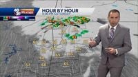
Meanwhile, as conditions shift to Arkansas, meteorologists are vigilant for potential storms that could develop across the area. 40/29 Meteorologist William Morrison notes that isolated to scattered storms are likely as a disturbance and a warm front converge, creating a possibility for severe weather. "The primary concern is large hail, but damaging wind gusts and/or a tornado cannot be ruled out," Morrison stated in a recent forecast. Storms may begin firing off as early as 8 or 9 PM across northwest Arkansas, particularly in Benton County and extending into Missouri. Best estimates indicate that the severe weather threat could persist until midnight.
On Sunday, March 23, residents can expect mild conditions, with early morning temperatures around 60 degrees before a cold front moves through the area, bringing showers and isolated thunderstorms. Despite the severe weather potential, temperatures throughout the day are predicted to remain above average, reaching around 70 degrees in northwest Arkansas and low to mid-70s in river valley areas.
As weather officials continue to monitor changes, both regions urge residents to stay prepared for rapidly changing conditions. In Montana, the blustery winds combined with the snowy weather signal the need for caution and awareness in travel plans. Likewise, in Arkansas, while the immediate threat of severe weather is relatively low, residents are advised to remain alert to updates concerning storm development and changing weather patterns.
As the night progresses, meteorologists in both areas stress the importance of being informed. With active weather challenges ongoing, keeping track of local alerts and forecasts will be key for safety in both Montana and Arkansas. An active weather outlook awaits in the coming days as a significant pattern shift may usher in more widespread weather events by March 27, bringing both regions back into the weather spotlight.
The dual focus on weather advisories in these diverse regions exemplifies how dynamic and unpredictable spring weather can be, necessitating preparedness and vigilance among residents.
As March 23 dawns, temperatures are expected to drop slightly, with chilly conditions marking Monday morning, registering in the 40s. New forecasts will continue to adjust as more data becomes available, emphasizing the importance of continually engaging with local news reports and weather channels during this unpredictable transitional phase.
In summary, both regions are facing unique challenges as evening weather conditions develop. While Montana combats winter's grasp with snow and wind, Arkansas gears up for potentially strong storms. The public's ability to adapt and receive up-to-date weather information will be crucial in keeping communities safe during this volatile time.