HOUSTON – Hold on to those umbrellas because the rain pattern remains in effect this week! A flood watch is currently issued for Burleson, Washington, Montgomery, and Liberty County until 1 a.m. on Wednesday, May 7, 2025. An area of low pressure is moving in from the west, potentially bringing heavy rain on Tuesday, May 6, and Wednesday, May 7. As this low-pressure system slowly drifts across Texas and Oklahoma, scattered storms and isolated severe thunderstorms are expected to ignite Tuesday afternoon.
According to the National Weather Service, the flood watch indicates that some rainfall totals could reach 6 inches or more over the next few days. Areas north and east of Houston are particularly vulnerable to flash flooding, as they received the bulk of the rain late last week. The forecast for Wednesday predicts a threat for street flooding, with rainfall amounts ranging from 2 to 6 inches possible in some regions.
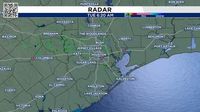
Tuesday morning's commute may be affected by light showers across Southeast Texas. However, a stray downpour or clap of thunder remains possible, especially along and west of Interstate 45. If you're traveling to Austin or San Antonio from Houston early Tuesday, be prepared for strong storms between 7 and 11 a.m. along the Interstate 35 corridor.
The High-Resolution Rapid Refresh model has depicted a line of strong and severe thunderstorms affecting areas mainly north of Houston early Tuesday afternoon. As the day progresses, storms are expected to become more frequent and potentially severe.
By early afternoon, a cluster of strong storms is expected to push toward Interstate 45 between 11 a.m. and 2 p.m. This initial wave of thunderstorms may primarily affect areas between the Brazos River Valley and the Piney Woods north of Houston. The National Weather Service warns that these storms may be severe, with the potential for large hail exceeding 2 inches in diameter and wind gusts reaching up to 60 mph. A stray tornado also remains a possibility.
The hail outlook from the National Weather Service’s Storm Prediction Center indicates that areas including Houston, Galveston, and Austin could experience hail larger than 2 inches in diameter. Additionally, areas near and north of Lake Livingston are under a level 2 out of 4 risk of flash flooding, with rainfall totals expected to range from 1 to 3 inches, although some higher totals are possible.
As the afternoon storms move eastward into Louisiana in time for the evening drive, a second round of thunderstorms is anticipated to erupt south of I-10 Tuesday evening. While specifics remain uncertain, any storm development will depend on how the activity evolves throughout the afternoon.
Rainfall totals across Southeast Texas are projected to accumulate between 1 and 3 inches for most areas, with the potential for much higher amounts throughout the week, especially through Wednesday, May 7. Storms that form overnight Tuesday into early Wednesday will likely produce heavy rainfall of 2 to 4 inches.
In summary, residents in Southeast Texas should stay alert and prepared for potentially severe weather conditions over the next couple of days. With the possibility of flash flooding, large hail, and damaging winds, it’s essential to monitor updates and take necessary precautions.
Once we get through Wednesday, the forecast looks to stabilize with morning temperatures expected to be in the mid-60s and afternoon highs reaching the 80s. So, while the rain may be a nuisance, a return to sunnier skies is on the horizon.