Tornado sirens rang out across Indianapolis on the night of April 2, 2025, as a confirmed twister was spotted in Brownsburg, a suburb located just outside the city. The National Weather Service (NWS) issued alerts warning residents of severe weather conditions affecting Indiana, with the tornado reportedly moving northeast at a speed of 65 mph.
According to the NWS, the tornado was confirmed to be over Carmel, approximately 11 miles north of Indianapolis. As the storm swept through the area, damage was reported in Brownsburg, where a building collapsed and the Sur La Table warehouse sustained significant damage. Fortunately, there has been no confirmation of injuries or individuals trapped under debris as of the latest updates.
This severe weather event is part of a larger outbreak affecting the Midwest, where officials have warned of life-threatening conditions. The NWS has issued a Tornado Warning for numerous counties in Indiana, including Boone, Hamilton, and Marion, with the warning remaining in effect until 11 PM EDT on the same night.
In addition to the tornado activity, the storm system has led to widespread power outages. Reports indicate that over 135,000 residents were without power as the storm wreaked havoc across the region. The severe weather has raised alarms about the potential for flying debris, which poses a significant risk to anyone caught outdoors without shelter.
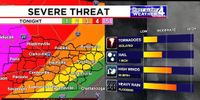
As the storm moved through the Midwest, the National Weather Service also highlighted the potential for severe weather extending from north Texas all the way to the Great Lakes. Cities such as Chicago, Cincinnati, and St. Louis are included in the severe weather outlook, which has been rated as a rare “high” risk (level 5 out of 5).
Meanwhile, in Missouri, severe weather has already claimed one life. Sgt. Clark Parrott of the Missouri State Highway Patrol confirmed that a fatality occurred between Advance and Delta, Missouri. Additionally, a highway patrol trooper was injured at his home in Advance but has since been treated and released from the hospital.
The severe weather has not only affected Indiana and Missouri but has also led to major storm alerts throughout parts of Middle Tennessee and Kentucky. On April 2, severe thunderstorms were reported, prompting multiple Tornado Warnings and Flash Flood Warnings throughout the region. A significant number of power outages were reported in Nashville, with 1,890 outages recorded by the Nashville Electric Service.
In Kentucky, two tornadoes were confirmed in Selmer, McNairy County, at 12:55 AM on April 2, and another tornado was spotted in Murray, Kentucky, at 9:37 PM that same evening. The severe weather has led to a First Alert Weather Day across the region, with meteorologists warning of gusty winds and the likelihood of severe storms.
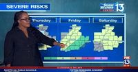
Weather experts have cautioned residents to prepare for a significant amount of rainfall, forecasting that some areas could see as much as 10 inches of rain by early April 6. Flood Watches have been issued, with warnings in place for areas near creeks, streams, and rivers, urging residents to move to higher ground if necessary.
As the storms continue to develop, officials emphasize the importance of being prepared. Residents are encouraged to have multiple ways to receive weather alerts and to stay informed about the evolving situation. The NWS has repeatedly advised individuals to seek shelter in the lowest level of their homes, ideally in a bathroom or closet without windows.
In the coming days, the severe weather threat is expected to persist, with forecasts indicating potential thunderstorms and additional tornado activity. The public is urged to remain vigilant and take all necessary precautions as the storms progress.
With the storm system continuing to impact a wide swath of the Midwest, communities are bracing for the aftermath of the severe weather. Emergency services are on high alert, ready to respond to any emergencies that may arise as a result of the storms. As always, the safety of residents remains the top priority for local officials and emergency responders.
As the situation develops, updates will continue to be provided to ensure that residents are kept informed about the ongoing severe weather and any necessary safety measures they should take. For now, the focus remains on recovery efforts in areas already impacted by the storms and preparation for those still in the path of the severe weather.


