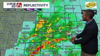
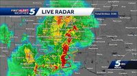
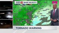
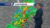
Severe weather is expected to hit Oklahoma overnight, bringing a risk of large hail, damaging winds, and a flooding threat due to heavy rainfall. The National Weather Service has issued multiple tornado warnings across the state as storms move east, prompting residents to take immediate precautions.
As of late Saturday night, April 19, 2025, several tornado warnings were in effect for various counties. A warning was issued for Pittsburg County until 12:45 a.m. on Sunday, April 20, 2025, and another for Atoka and Bryan counties until the same time. Additional warnings were also issued for McIntosh and Pittsburg counties, as well as Okmulgee County until 12:30 a.m.
In a concerning development, a tornado warning was issued for a storm located near Calvin, moving northeast at 25 mph. Atoka, Coal, and Johnston counties were also warned until 12:15 a.m. More warnings were added for Coal and Hughes counties, and Bryan County until midnight.
As the severe weather unfolded, first responders were called to assist after two vehicles were swept off the road in southeast Moore. The Moore Police Department confirmed that a truck and a Jeep were involved in the incident. Fortunately, the driver of the truck and his son were able to escape, while one person in the Jeep was accounted for. However, two individuals were still unaccounted for as of 10:45 p.m.
In addition to tornado warnings, a flood warning was issued for Pottawatomie, Seminole, and Atoka counties. Heavy flooding was reported in Moore, prompting police to respond to numerous motorist assists. Drivers were urged to stay off the roads, especially in areas experiencing significant flooding.
KOCO 5 Field Meteorologist Michael Armstrong reported that a truck was almost completely submerged near SW 4th Street and Interstate 35. The driver managed to exit the vehicle and return home safely. Emergency services were active in areas known to experience flooding, including Broadway and SW 19th Street.
As the night progressed, tornado warnings continued to be issued for various regions. A warning for Hughes County covered a storm near Yeager, while another warning was issued for Bryan and Marshall counties until 11:15 p.m. Residents in Holdenville were advised to take shelter immediately as a tornado approached.
Warnings also extended to Hughes, Pontotoc, and Seminole counties until 11 p.m., with a confirmed tornado located near Francis, moving northeast at 20 mph. The weather service advised that anyone in the path of these storms should seek shelter.
Reports indicated that a severe thunderstorm capable of producing a tornado was located near Fitzhugh, prompting further warnings for Pontotoc County until 10:30 p.m. The storm was moving northeast at a speed of 15 mph.
In addition to tornado warnings, severe thunderstorm warnings were issued for parts of Love and Carter counties, with the potential for damaging winds and large hail. Heavy rainfall was expected to continue through the night, with rainfall amounts possibly reaching between 1 and 2 inches.
The severe weather risk is projected to persist into early Sunday morning, particularly along the I-35 corridor and eastward. For those attending sunrise services on Easter, the forecast indicates that heavy rain and storms may impact the morning.
As the storms developed, meteorologists cautioned residents about the potential for severe weather. KOCO 5 Meteorologist Sabrina Bates noted that the tornado risk would remain concentrated in southern and southeastern Oklahoma. Areas such as Ardmore, Ada, and McAlester were identified as having a heightened risk of severe storms.
In light of the ongoing severe weather, the University of Oklahoma (OU) sent out a mass email to inform students and faculty about safety measures. The email outlined the importance of identifying a safe place at home and following the “get in, get down, cover” strategy during a tornado warning. This includes choosing an interior room on the lowest floor and using helmets, blankets, or pillows for protection against debris.
As Oklahoma braced for the worst of the storm, residents were reminded to stay vigilant and monitor local weather updates. The National Weather Service emphasized that a tornado watch means conditions are favorable for tornado formation, while a tornado warning indicates that a tornado has been sighted or indicated by radar.
With the potential for severe weather lingering into the early hours of Sunday, residents across Oklahoma are urged to remain prepared and informed. Emergency services are on standby, and community members are encouraged to heed all warnings and advisories issued by local authorities.
As the situation develops, it is crucial for residents to stay connected with local news outlets and weather services for real-time updates on the storm's progress and any necessary safety precautions.


