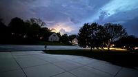
Thunderstorms swept through the Greater Cincinnati area late on Wednesday, April 2, 2025, bringing with them a tornado watch that is set to expire early Thursday morning. The National Weather Service (NWS) in Wilmington issued the watch for virtually all of Greater Cincinnati, including Northern Kentucky and Southeast Indiana, highlighting the potential for severe weather.
The tornado watch is effective until 4 a.m. on Thursday, April 3, 2025, as thunderstorms are expected to last through the night. According to NWS meteorologist Ashley Novak, the storms are anticipated to hit the region around 1 a.m. and last for about an hour. Residents can expect heavy downpours, damaging winds, and even hail, with the possibility of tornadoes looming.
In addition to the tornado watch, a flood watch is in effect until 8 a.m. on Sunday, April 6, 2025. The NWS warns that the saturated soils and excessive runoff could lead to flooding of rivers, creeks, streams, and other low-lying areas prone to flooding. Some tornado warnings have already been issued to the north of Cincinnati, particularly near the Dayton area.
As the storms move through, Novak indicated that residual thunderstorms and showers are likely, tapering off by around 6 a.m. Thursday. However, more rain is expected later in the day, especially after 2 p.m., with the potential for additional storms into the evening.
In response to the severe weather forecast, Kentucky Governor Andy Beshear declared a state of emergency on Wednesday. His executive order allows for an emergency response plan to be coordinated from the Kentucky Emergency Operations Center and mobilizes the Kentucky National Guard to assist. Beshear expressed particular concern for the high risk of tornadoes in western Kentucky, including the possibility of strong tornadoes rated EF-2 or greater.
“Remember, these can be strong tornadoes, EF-2 and greater,” Beshear warned. “We’re really concerned about people’s safety, especially in the overnight, because when storms or tornadoes hit while people are asleep, that’s sadly when we’ve lost the most people. So, everybody out there, be really careful.”
To further protect residents, Beshear activated the state's price gouging laws, advising consumers to report any instances of price gouging to the Office of the Attorney General.
As the storms approach, the NWS is urging residents to prepare for emergency situations. They recommend having multiple ways to receive weather alerts, such as following the NWS’s updates on their X account or signing up for local alert systems through the Hamilton County Emergency Management Agency or the city of Cincinnati. An NOAA weather radio is also advised for real-time updates.
In the event of a tornado, the NWS advises residents to have a safe place prepared ahead of time. Phones should be charged and readily available, and emergency supplies should be on hand. If a tornado warning is issued, individuals should move to their basement or an interior room without windows. The NWS emphasizes that top-floor rooms and exterior rooms with windows do not offer adequate protection from tornadoes.
In addition to Cincinnati, other regions in the Midwest are also bracing for severe weather. West Michigan is facing a mix of snow and freezing rain, with the National Weather Service in Grand Rapids indicating that the severe weather could include damaging winds, flooding, hail, and even tornadoes.
As of late Wednesday, April 2, 2025, a flood watch has been issued for southeast Michigan, including metro Detroit, from 8 p.m. Wednesday to 8 a.m. Thursday. The NWS has warned that damaging winds could reach up to 70 mph, especially south of I-94, where the highest risk for severe storms is expected.
Residents of Michigan are advised to prepare for another wave of storms, with tornadoes being a possibility. The NWS has defined the differences between tornado watches and warnings, explaining that a watch means conditions are favorable for tornadoes, while a warning indicates that a tornado has been sighted or indicated by radar, signaling imminent danger.
As the severe weather unfolds across the region, residents are encouraged to stay informed and take necessary precautions to ensure their safety. With multiple rounds of storms expected through the weekend, including heavy rainfall that could lead to flooding, vigilance is key.
As the NWS continues to monitor the situation, updates will be provided as necessary. Residents are urged to heed all warnings and stay safe during this period of severe weather.


