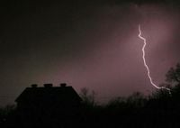
Severe weather swept across parts of the Central United States on Wednesday, April 23, 2025, with thunderstorms and tornado warnings affecting multiple counties in Texas and Kansas. The National Weather Service (NWS) issued a series of warnings throughout the day, prompting residents to remain vigilant as storms developed and intensified.
In Texas, a severe thunderstorm watch was issued for several counties, including Dickens, Floyd, Garza, Hale, Hall, Hockley, Kent, King, Lamb, Lubbock, Lynn, and Motley, effective until midnight on Thursday, April 24. This watch indicated the potential for severe weather, including damaging winds and large hail.
Additionally, the NWS issued severe thunderstorm warnings for Bailey, Lamb, Gaines, Seminole, Cottle, Dickens, King, and Motley counties until 10 p.m. on Wednesday. Another severe thunderstorm warning was in effect for Terry and Yoakum counties until 9:30 p.m. Residents in these areas were advised to take precautions and stay tuned to local news updates for the latest information.
Meanwhile, in northeast Kansas, tornado warnings were also issued, marking a particularly tense afternoon for residents. Just after 4:45 p.m., the NWS alerted residents in Jefferson, Shawnee, and Jackson counties of the impending danger, with warnings set to expire at 5:15 p.m. The NWS warned of half-dollar-sized hail accompanying these storms, which raised concerns about potential damage to property and vehicles.
As the tornado warnings expired, the NWS continued to monitor the situation and issued severe thunderstorm warnings for Douglas, Osage, and Shawnee counties, lasting until 5:45 p.m. A later update noted a severe thunderstorm warning for Osage County until 6:15 p.m., indicating that residents could experience hail up to one inch in diameter.
In Greene County, Iowa, the weather also took a turn for the worse, as a quick thunderstorm warning was issued at 8:16 p.m. The NWS reported varying sizes of hail throughout the area, with Greene County Sheriff Jack Williams noting that pea-sized hail was observed in Jefferson, while Churdan experienced ping-pong ball-sized hail later in the evening. The storm brought heavy rainfall and winds reaching up to 40 miles per hour, creating hazardous conditions.
The severe thunderstorm warning for Greene County was lifted at 8:40 p.m., but the Raccoon Valley Radio Severe Weather Action Team provided live coverage of the storm, ensuring that residents were informed and safe during the severe weather event. The team, which included Sheriff Williams and Weatherology Metrologists, worked diligently to keep the community updated as storms moved through the region.
As the severe weather continued to impact various regions, local emergency management agencies urged residents to remain prepared and have a plan in place. With unpredictable weather patterns becoming increasingly common, staying informed and ready to respond is more critical than ever.
In summary, the severe weather on April 23, 2025, affected numerous counties across Texas and Kansas, with tornado warnings and severe thunderstorm warnings prompting significant concern among residents. The NWS's timely alerts and local news coverage played a vital role in keeping communities informed and safe during these dangerous weather conditions.


