As Mexico gears up for the weekend, meteorologists are warning of a dramatic shift in weather conditions, particularly on Saturday, April 19, 2025. A new cold front is set to sweep across the northern regions of the country, bringing with it the potential for snowfall in elevated areas of Sonora and Chihuahua. This system, which is expected to interact with the Polar Jet Stream and a dry line, will also trigger thunderstorms and strong winds across various states.
According to the National Water Commission (Conagua), an unstable atmospheric system will begin to influence the weather from Friday night into Saturday morning. The combination of a high-pressure ridge, a dry line over Coahuila, and moisture influx from both the polar and subtropical jet streams will significantly alter the climatic conditions in northwest and northern Mexico. Areas such as Baja California, Sonora, Chihuahua, and Coahuila may experience rain accompanied by electrical storms.
"We expect isolated showers in Baja California Sur, Nuevo León, and Tamaulipas, with strong winds reaching up to 120 km/h in Sonora and Chihuahua, and 60 to 80 km/h in Baja California," said a Conagua spokesperson. The winds are likely to create dust devils in Coahuila and high gusts of 60 to 80 km/h in Nuevo León and Tamaulipas.
As the cold front moves in, the northeastern regions of Mexico will see a heightened risk of tornadoes, particularly in northern Coahuila and Nuevo León. Meanwhile, the center and southeast of the country will be affected by low-pressure channels associated with moisture from the Pacific Ocean, the Gulf of Mexico, and the Caribbean Sea, leading to showers and thunderstorms in states like Chiapas, Oaxaca, and Veracruz.
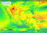
In stark contrast to the impending storms, much of the country will experience a persistent heat wave due to an anticyclonic circulation in the mid-atmosphere. This will inhibit rainfall in many areas, resulting in hot to very hot conditions across states including Jalisco, Colima, Michoacán, Guerrero, and Oaxaca. Maximum temperatures could soar to between 40 and 45 °C in these regions.
The forecast for Saturday, April 19, 2025, includes:
- Intervals of showers (5 to 25 mm) expected in Coahuila, Nuevo León, Tamaulipas, Oaxaca, and Chiapas.
- Isolated rainfall (0.1 to 5 mm) anticipated in Sonora, Chihuahua, San Luis Potosí, Querétaro, Hidalgo, Veracruz, Puebla, Estado de México, Campeche, and Quintana Roo.
- Potential snowfall or sleet in high-altitude areas of Sonora and Chihuahua.
As the cold front makes its way into the country, strong winds are predicted to exacerbate the risk of forest fires and reduce visibility on highways and roads across several states. Wind gusts could reach 70 to 90 km/h in Sonora, Chihuahua, and Durango, while areas like Tamaulipas and Campeche may see gusts of 50 to 70 km/h.
In the central and western parts of Mexico, wind speeds are expected to range from 30 to 50 km/h, with gusts between 40 and 60 km/h in Tabasco, Campeche, Yucatán, and Quintana Roo. The coastal regions of Tamaulipas, Veracruz, and Yucatán could experience waves of 1 to 2 meters in height due to these strong winds.
The temperature forecast for Saturday is as follows:
- Maximum temperatures of 40 to 45 °C in Michoacán, Morelos, Guerrero, and Oaxaca.
- Maximum temperatures of 35 to 40 °C in Sinaloa, Nayarit, Jalisco, Colima, Chihuahua, Durango, Coahuila, Nuevo León, Tamaulipas, San Luis Potosí, Guanajuato, Querétaro, Hidalgo, Estado de México (southwest), Puebla, Veracruz, Tabasco, Chiapas, Campeche, and Yucatán.
- Minimum temperatures ranging from -10 to -5 °C with frost in mountainous regions of Baja California, Chihuahua, and Durango.
- Minimum temperatures of 0 to 5 °C in areas of Sonora, Zacatecas, Michoacán, Estado de México, Tlaxcala, and Puebla.
As the weather unfolds, residents are urged to stay informed and prepared for rapidly changing conditions. The potential for severe weather, including thunderstorms and strong winds, means that safety precautions should be taken seriously.
In summary, the weather on Saturday, April 19, 2025, is expected to bring a mix of severe storms, high winds, and extreme temperatures across different regions of Mexico. While some areas prepare for the possibility of snow, others will be grappling with intense heat, underscoring the diverse and sometimes extreme nature of Mexico's climate.