Significant severe weather swept through Pennsylvania on March 17, 2025, leading to the confirmation of multiple tornadoes across the region. According to the US National Weather Service (NWS) based in Pittsburgh, at least three tornadoes were confirmed during damage assessments conducted on March 17 and 18.
The first tornado was identified around Deongal, located in Westmoreland County, where damage consistent with an EF-1 tornado was reported. This addition marks the first tornado occurrence for the county since June 2024. The NWS stated, "The EF-1 tornado classification indicates winds between 86 and 110 mph and can cause moderate damage to buildings and trees, among other effects."
Two additional tornadoes were confirmed within Indiana County, both categorized as EF-1 storms. One was located near Ligonier and the other near Josephine, both areas also last encountering tornado conditions back in June 2024. Local residents reported alarming winds and unusual weather patterns, typical of the spring season but intensified this year.
Further details from the Latrobe Airport revealed impressive wind gusts recorded at 89 mph, making this the third highest gusts at the location since officials began tracking wind data in 1976. These gusts contributed significantly to the damage situation across the two counties.
An active Tornado Watch was issued across multiple Midstate counties, allowing residents to remain alert to the severe weather system passing through. Despite the warnings, the situation did not escalate to emergency tornado warnings, which often require immediate action from the public. This was welcome news for local communities still recovering from previous weather-related incidents.
Local authorities are encouraging residents to stay informed through reliable updates from the National Weather Service and to be prepared for the unpredictable nature of spring storms. Emergency management teams are on high alert, emphasizing the importance of readiness and safe practices during severe weather.
While the tornadoes have caused damage, no serious injuries have been reported at this time. Community organizations are coming together to assist those affected, offering aid and support as recovery efforts begin. Local government meetings are being held to address any impacts on infrastructure and to establish improvement plans moving forward.
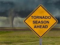
With weather patterns showing signs of volatility, experts predict more severe weather may occur as spring progresses. Often, the time frame from late winter to late spring can see spikes in severe thunderstorm activity across the Midwestern and Northeastern United States. Residents are advised to monitor forecasts closely as conditions can change rapidly.
The recent inclement weather and its consequences serve as reminders of the power and unpredictability of nature, leaving many reflective on the resilience of communities during such trials. Preparedness and awareness remain the best tools for safety as the season progresses.