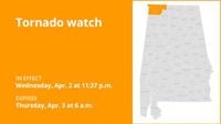
On Wednesday, April 2, 2025, at 11:37 p.m., the National Weather Service (NWS) issued a tornado watch for Colbert and Lauderdale counties, effective until 6 a.m. the following morning. This alert warns residents to be prepared for potential tornado formation as severe weather conditions were anticipated in the area.
The distinction between a tornado watch and a tornado warning is crucial for safety. A tornado watch indicates that conditions are favorable for tornadoes, prompting individuals to review their emergency plans and ensure their supplies are ready. In contrast, a tornado warning signifies that a tornado has been spotted or indicated by radar, necessitating immediate action to protect life and property.
As the severe weather season peaks from March through May in Arkansas, residents are reminded to stay informed about the forecast and know how to respond during such events. The NWS emphasizes the importance of having a communication plan and a designated safe room within homes. Regular family drills for severe thunderstorms can also prepare individuals for when a tornado threat arises.
In addition to the tornado watch, various warnings were issued across the region on the same day. At 11:08 p.m., the NWS released a tornado warning for portions of Monroe, Bartholomew, Brown, Jackson, and Lawrence counties until 11:30 p.m., due to radar indications of a possible tornado. Residents were urged to seek shelter immediately in a windowless room on the lowest level of their homes.
Earlier that evening, at 11:05 p.m., Southern Monroe County was under a severe thunderstorm warning, which spread to Mitchell, Freetown, and Nashville, Indiana, until 11:30 p.m., with high winds reported. The NWS advised residents to take shelter in sturdy buildings and to leave mobile homes that could be overturned in high winds.
By 11 p.m., a flash flood warning was issued for Bloomington and much of Monroe County, as well as portions of Morgan, Brown, and Johnson Counties, lasting until 2 a.m. Thursday. This warning indicated that flooding was occurring or imminent, and residents in flood-prone areas were urged to seek higher ground immediately.
At 10:45 p.m., another tornado warning was issued for areas south of Monroe County, including Bedford, Mitchell, Pleasant View, and Heltonville, also due to radar indications of a potential tornado. Residents were advised to remain calm and seek underground shelter if possible.
As severe weather continued to impact the region, Duke Energy reported that 132 customers were without power in Bloomington, primarily south of Indiana University’s campus. The outages were likely related to the severe thunderstorms that struck the area earlier in the evening, which included wind gusts of up to 60 mph and penny-sized hail.
At 9:20 p.m., Bloomington was already under a severe thunderstorm warning, with the potential for tornadoes, flash flooding, and hail. The NWS noted that all of central and southern Indiana was under a moderate risk for severe weather, with predictions for thunderstorms to develop into the early morning hours of April 3.
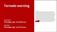
As the storm system moved through the area, the NWS issued a tornado warning for Greene County on Thursday, April 3, at 5:07 a.m., indicating that a severe thunderstorm capable of producing a tornado was located over Cassville, moving northeast at 60 mph. Residents in affected areas were advised to take immediate shelter in well-constructed buildings, away from windows.
Understanding the difference between tornado watches and warnings can be a matter of life and death. The NWS encourages everyone to stay vigilant and informed during severe weather seasons. Regularly tuning into local news or a NOAA Weather Radio can provide critical updates on tornado watches and warnings.
For those who find themselves outdoors during a tornado warning, the safest option is to seek shelter inside a sturdy building. Mobile homes, tents, and sheds are not safe options. If no shelter is available, individuals should lie down flat in a low-lying area, such as a ditch, and protect their heads from debris.
In preparation for severe weather, the NWS recommends that residents keep enough food, water, and medicine on hand to last at least three days in case of an emergency. Having a NOAA Weather Radio or other battery-operated radio is also advised to stay informed about ongoing weather conditions.
After a tornado has passed, it is essential to remain informed about any further warnings or watches. Residents should check on family and neighbors and assess any damage to their properties. If power lines are down, contacting local authorities is vital for safety.
As the severe weather season progresses, the NWS continues to monitor conditions and issues alerts as necessary. Residents are encouraged to stay prepared and informed to ensure their safety during this unpredictable time.


