A Tornado Watch is now in effect for areas north-northeast of San Antonio until 4 p.m. on Tuesday, May 6, 2025. The National Weather Service (NWS) is predicting heavy rainfall through Tuesday evening, with a chance of rain spilling into early Wednesday as well. The areas at greatest risk for tornadoes include parts of the Hill Country and the I-35 Corridor.
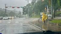
Severe weather could also bring large hail, damaging winds, and locally heavy downpours of 2 to 3 inches of rain. According to NWS Meteorologist Cory Van Pelt, storms are expected to move through the Austin area before noon, with some activity possible later in the afternoon. "We're going to have a couple of rounds of showers and storms coming from the west," Van Pelt stated. "The individual cells are moving northeast, and the whole system is moving eastward, and we're thinking it'll be out of here by afternoon."
A flash flood warning is in effect for northern Travis County and Williamson County until 2:30 p.m. on Tuesday. The NWS cautions residents to "turn around, don't drown" when encountering flooded areas. A tornado watch has also been issued for Williamson, Travis, and Hays counties until 4 p.m., indicating that weather conditions could lead to severe storms and tornadoes. "A tornado watch is more of a general alert to let people know that the atmosphere has the ingredients to produce storms that could become tornadic," Van Pelt explained. "A tornado warning means that we've seen rotation on radar or gotten reports that one is occurring."
If a tornado warning is issued, residents are advised to take immediate shelter, moving to an interior room on the lowest floor of a sturdy building and avoiding windows. For those in mobile homes, vehicles, or outdoors, seeking the closest shelter is crucial to protect against flying debris.
On Tuesday, May 6, 2025, severe weather is forecasted across Central Texas. A tornado watch is in effect for most of the area until 4 p.m., with large hail, strong winds, and isolated tornadoes all possible. Most of Central Texas is under a slight risk (level 2 of 5) of severe weather, while locations northeast of Austin are under an enhanced risk (level 3 of 5). At 12:16 p.m., the NWS confirmed that a tornado was on the ground in Milam County, near Cameron.
Earlier in the day, a tornado watch was issued across a massive part of Texas. The NWS warned of a few likely tornadoes, apple-sized hail, and scattered winds up to 70 miles per hour in Central Texas cities like Austin, San Marcos, and Fredericksburg. Other regions included in the tornado advisory are Kingsland, Killeen, Waco, College Station, Brenham, Conroe, and Houston. San Antonio falls just outside the affected area.
The tornado watch began a little after 8 a.m. on Tuesday and is expected to last until 4 p.m. This advisory could potentially impact over 10.6 million Texans, affecting more than 2,600 schools and 180 hospitals in the region. Burnet County, located north of Austin, was previously hit by a tornado on Thursday, May 1, which destroyed one home, damaged another, and hospitalized a driver.
Austin's forecast for Tuesday includes an 80% chance of precipitation with showers and possibly a thunderstorm before 1 p.m. There's also a chance of severe showers and thunderstorms between 1 and 4 p.m. The high temperature is expected to reach 87 degrees, with winds gusting up to 20 mph. New rainfall totals could amount to between half an inch and three-quarters of an inch. On Wednesday, May 7, there will be a 30% chance of showers and thunderstorms, mainly after 1 p.m., with a high near 86 degrees.
As the severe weather unfolds, residents are encouraged to stay informed by following local weather updates. Many are turning to social media platforms, such as X (formerly Twitter), to keep abreast of the latest developments. The NWS Austin/San Antonio account is a reliable source for timely weather alerts and updates.
In the meantime, local authorities are taking precautionary measures to ensure public safety. For example, Cedar Park Police have reported that several low water crossings are closed due to flooding. These include 2348 Cypress Lane, 2400 Sumac Lane, and 2402 Peach Tree Lane. Additionally, traffic lights are flashing red at US 183A and E. Whitestone Boulevard, indicating hazardous conditions.
As the day progresses, the situation will continue to be monitored closely. Residents are urged to remain vigilant and prepared for rapidly changing weather conditions. The NWS emphasizes the importance of having a plan in place for severe weather events, including knowing where to seek shelter and having emergency supplies readily available.
In conclusion, as Central Texas braces for severe weather, the community is reminded to stay alert and take necessary precautions. With the potential for tornadoes, heavy rainfall, and severe thunderstorms, being informed and prepared could make all the difference.