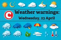
South Africans should brace themselves for a significant weather shift this week as a cut-off low (COL) pressure system approaches the region. The South African Weather Service (SAWS) has issued warnings regarding widespread showers, thunderstorms, and a notable drop in temperatures, with the system expected to make landfall over the western interior on Wednesday, April 23, 2025.
According to SAWS, a cut-off low is a low-pressure system that becomes detached from the main atmospheric flow, often lingering in one area and leading to intense weather conditions, including heavy rainfall and thunderstorms. This particular system is forecasted to move eastward, exiting the country by Saturday, April 26, 2025.
On Wednesday and Thursday, April 23 and 24, 2025, scattered to widespread showers and thundershowers are anticipated, especially in the central and eastern parts of South Africa. Rainfall accumulations are expected to exceed 50 mm in the eastern regions during this period. SAWS warns that severe thunderstorms may lead to flooding of roads and settlements, posing risks to infrastructure, property, vehicles, livelihoods, and livestock, particularly in the Free State and North West provinces. Damaging hail is also a possibility with these thunderstorms.
Adding to the weather woes, snowfalls are likely over the Drakensberg mountains in Lesotho, KwaZulu-Natal, and the Eastern Cape during this time. Daytime temperatures are predicted to drop significantly from Wednesday onward, with a gradual recovery starting on Friday, April 25, 2025.
As the country prepares for the impact of this cut-off low, vigilance is essential. Authorities and emergency services are urging communities to stay alert, particularly in areas prone to flooding or snowfall. Motorists and residents in low-lying areas should take extra precautions, while farmers and rural communities are advised to prepare for potential damage to infrastructure and livestock.
In a detailed forecast released on the same day, SAWS highlighted severe thunderstorms expected to result in heavy downpours and possible flooding in parts of the Free State, KwaZulu-Natal, Mpumalanga, Gauteng, and North West. An orange level 5 warning has been issued for severe thunderstorms leading to flooding of roads and bridges, as well as damage to property and agricultural activities in the eastern parts of the Free State. Meanwhile, a yellow level 4 warning is in effect for severe thunderstorms resulting in localized flooding and hail in the western parts of KwaZulu-Natal, the extreme southern Highveld of Mpumalanga, and Gauteng.
A yellow level 2 warning has also been issued for localized damage to settlements and flooding in the north-eastern parts of the Northern Cape, Free State, and North West. Additionally, a yellow level 1 warning is in place for possible strong winds and excessive lightning in the north-eastern parts of KwaZulu-Natal during the early morning hours.
Cold and wet conditions are expected to persist over the central and western parts of KwaZulu-Natal until Thursday, April 24, 2025. Very cold weather, along with the possibility of light snowfall, is forecast for the south-western high grounds of the region.
Residents across various provinces can expect varied weather conditions on Wednesday, April 23, 2025. In Gauteng, warm weather is anticipated in the north, while cloudy and cool conditions with scattered showers and thundershowers are expected in the south-west. Mpumalanga residents will experience morning fog along the escarpment, with cloudy and cool conditions prevailing, alongside isolated to scattered showers and thundershowers.
Limpopo is set for a cloudy and warm day with isolated showers and thundershowers in the western and southern regions. North West will experience cloudy and warm to cool weather, with scattered showers and thundershowers, particularly in the central and southern parts.
In the Free State, cloudy and cool to cold weather will dominate, with scattered showers and thundershowers expected, especially in the east. The Northern Cape will begin with morning fog along the coast, transitioning to cool to cold conditions with isolated showers and thundershowers in the central parts.
The Western Cape is forecasted to have morning fog patches along the west coast, followed by cloudy to partly cloudy conditions and cool to warm temperatures, with isolated showers and thundershowers in the north-eastern areas.
The Eastern Cape will experience cloudy and cold weather, with scattered showers and rain expected, particularly in the western half. In KwaZulu-Natal, cool weather conditions will prevail in the north-east and along the coast, while the extreme south-west will be very cold, accompanied by widespread thundershowers.
As the weather system approaches, South Africans are encouraged to remain informed through official updates from the South African Weather Service. With timely information and careful planning, the impacts of the cut-off low can be managed effectively, ensuring the safety and resilience of communities during this period of unsettled weather.