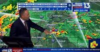
As spring unfolds across the southern United States, residents are bracing for a multi-day severe weather event that poses significant risks of flooding and storms. Starting today, April 3, 2025, an ALERT DAY has been declared, with meteorologists warning of a rare HIGH risk for flooding, particularly near and north of Interstate 40.
The day began with warm conditions, as temperatures climbed into the mid to upper 70s, but the atmosphere is set to change dramatically. According to Patrick Ellis, a meteorologist with Action News 5, "Heavy rains are expected to fall on areas already saturated from previous storms. This could lead to frequent and possibly significant flooding instances." As the front wavers overhead, temperatures near the front will hover in the cooler 60s to near 70, while areas south of it will experience warmer, muggy conditions.
As the day progresses, the weather is expected to become more volatile. An ENHANCED severe weather risk will develop, with strong storms moving from west to east along the boundary. These storms could produce damaging winds, large hail, and even a threat of tornadoes. Ellis emphasized the importance of staying informed, stating, "Residents should remain alert and prepared for rapidly changing weather conditions today."
Looking ahead to Friday, April 4, 2025, a brief respite may occur as the front lifts northward in the morning. However, this will not come without consequences. Heavy rain is still expected near and north of I-40 through midday, and storms are likely to become more prevalent in northeast Arkansas as the day progresses. Many areas will transition to warmer, muggy air with highs reaching the 80s. Any storms that develop will have the potential to be strong to severe.
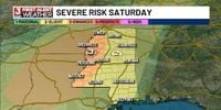
As evening approaches on Friday, rain and storm chances will ramp up again ahead of a final push on Saturday, April 5, 2025. Another ALERT DAY has been issued for Saturday, as a potent push of cooler air is anticipated to push the front southward, clearing the board for what could be a significant weather event. Ellis noted, "Saturday afternoon and evening may bring another round of strong to severe storms, with widespread rainfall totals of 4-8 inches expected by the end of the week. In some localized areas, totals could reach 8-12 inches, leading to river, overland, and flash flooding that could be significant."
In Jackson, Mississippi, the weather is similarly warming up, with record highs recorded just yesterday. Meridian hit 88°F, while Vicksburg reached a scorching 90°F. As of today, April 3, 2025, temperatures are expected to continue climbing, with strong winds gusting between 30-40 mph. Fortunately, the severe weather is expected to remain to the northwest, allowing residents to enjoy a brief calm before the storm.
By Saturday, the boundary will move into the Jackson area, bringing a heightened risk of storms, particularly in the afternoon and evening. An Enhanced risk (Level 3/5) has been issued for areas along and west of Interstate 55, where severe weather is likely. Meteorologists remain cautious, noting that while severe storms are probable, it is still uncertain whether they will be widespread or isolated. A spokesperson from WLBT remarked, "We advise everyone to stay updated as we approach the weekend and to prepare for potential severe weather conditions."
As the severe weather unfolds, residents across the affected regions are urged to remain vigilant and prepared. Emergency services and local officials are on standby to respond to any incidents as they arise. Ellis concluded, "Next week looks to be quieter and cooler, but until then, safety should be everyone's top priority."
With the ongoing severe weather threat, it is essential for communities to stay informed and heed any warnings issued by local meteorologists. The potential for significant flooding and severe storms serves as a reminder of the power of nature and the need for preparedness in the face of unpredictable weather.


