Severe storms swept across a vast area of the United States on Friday, May 2, 2025, bringing with them hail, flooding, and tornado warnings. These storms stretched from Texas to the Gulf Coast, causing significant disruptions and raising concerns over emerging flood risks in the central U.S. As the storms made their way northeast, meteorologists predicted they would stall, potentially leading to further complications over the weekend.
In Texas, multiple tornadoes were reported as the severe weather moved through, with residents experiencing the dual spectacle of hail and a rainbow in some areas. The first day of May had already delivered severe storms nationwide, and the latest weather patterns suggested a continuation of unsettled conditions.
According to the National Weather Service, the storms were not just an isolated event but part of a larger system affecting vast regions. The weather outlook for the weekend, particularly concerning the 151st Kentucky Derby, indicated rain chances throughout the day on Saturday, which could impact the horse racing event.
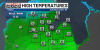
In Saginaw, Michigan, following Thursday’s rain, the weather on Friday was relatively calm but cooler than average. Highs reached only 58 degrees, which is below the normal high of 63 degrees for this time of year. The forecast for the weekend suggested that both Saturday and Sunday would trend cooler, with temperatures struggling to reach the 50s.
On Saturday, May 3, 2025, the weather was expected to be mostly cloudy, with highs around 55 degrees. A northeast wind at 10 to 15 mph, gusting to 20 mph, would make it feel even cooler, especially in shoreline areas where temperatures could dip into the 40s. Overnight lows were forecasted to sink to around 39 degrees.
Looking ahead to Sunday, May 4, 2025, the day was anticipated to start with a partly to mostly sunny sky. However, clouds were expected to build up throughout the afternoon and evening, with rain showers moving in from the south. Highs on Sunday were predicted to reach about 57 degrees, with a northeast wind that could gust up to 25 mph.
The low-pressure system to the south, situated closer to the Ohio River Valley, is expected to become cut off from the jet stream, causing it to stall out and not move east until Tuesday night. This stalling pattern could lead to scattered shower chances continuing into next week, keeping residents on alert for changing weather conditions.
As the Eta Aquarid meteor shower approaches, stargazers may find it challenging to enjoy the celestial display due to the cloud cover and potential rain. The meteor shower is expected to peak in early May, but the adverse weather could hinder visibility.
In summary, the severe storms that struck on Friday, May 2, 2025, are a stark reminder of the unpredictable nature of spring weather in the U.S. As the country braces for more storms and cooler temperatures over the weekend, residents are urged to stay informed and prepared for rapidly changing conditions.