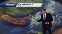
A strong storm system is moving into western Washington, foreboding a night of severe weather that could usher in dangerous conditions for residents. Meteorologist Ilona McCauley from FOX 13 Seattle is tracking this significant atmospheric event, which is expected to accompany lightning, hail, heavy rain, and high winds.
On March 25, 2025, Western Washington experienced record warmth with several locations making headlines. Sea-Tac Airport registered a scorching 73 degrees, surpassing the previous record of 64 degrees. Olympia also felt the heat, reaching 71 degrees and breaking its former record of 67 degrees. Both Bellingham and Quillayute experienced similar conditions, each setting new record highs.
The calm before the storm is set to be short-lived, as the Storm Prediction Center has warned that a rare setup of substantial severe storms is looming for the evening of March 26. "A rare setup of strong and severe storms is in place for Wednesday evening," McCauley stated. This unusual atmospheric scenario includes ample warm, humid air colliding with a powerful low-pressure system and advancing cold front, triggering conditions ripe for severe weather.
As a result, weather experts are forecasting various risks associated with the storms. "The main risks with the storms will be dangerous and frequent lightning, damaging winds along with heavy rain and hail," McCauley explained. There is also a slight risk of isolated weak tornadoes, adding to the potential dangers residents may face.
For most of the day on March 26, weather conditions in Western Washington will remain calm. However, residents should prepare for significant changes by the evening, when storms begin to move in from the south towards Puget Sound. The forecast suggests storms will begin to develop around 6 p.m. and continue through the night, increasing in intensity as they pass.
Following the stormy weather on Wednesday, a substantial temperature drop is expected along with calm conditions for Thursday morning, March 27. McCauley noted, "After a stormy day on Wednesday, we will cool back off once again with slight chances of rain throughout the week," as the region begins to recover from the dramatic shift in weather.
As residents brace for what promises to be a stormy evening, keeping updated on forecasts and safety measures will be crucial to navigate this weather event. The National Weather Service alongside local meteorological reports will continue to monitor the situation closely, ensuring that everyone is well-informed and prepared for the changing conditions ahead.