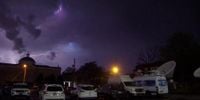
Severe storms swept across the Mid-South region on Thursday, April 3, 2025, leaving a trail of destruction and chaos in their wake. Reports confirmed tornado damage in several areas, including west of Senatobia, Mississippi, Lake City, Arkansas, and Selmer, Tennessee. Residents are now grappling with the aftermath of these powerful storms as emergency responders assess the damage.
In Mississippi, a tornado touched down in the Marshall County area near Slayden and Atway, impacting communities such as Early Grove, Highway 311, and Hurdle Club. Action News 5 reporters were on the scene, with Tarvarious Haywood covering the devastation in Lake City and Garner Montgomery documenting the destruction in Senatobia. Imani Williams provided a live report from Dyer County, where the impact of the storms was palpable.
Meanwhile, Kentucky also faced severe weather, with at least two tornadoes confirmed as part of a system that began on the night of April 2 and continued into the early hours of April 3. A tornado was reported near Murray around 10 p.m. on Wednesday, and another struck near Middletown in Louisville early Thursday morning, according to the National Weather Service (NWS).
In far Western Kentucky, near Gage, another tornado may have touched down, resulting in injuries to four individuals, with one person reported in critical condition. The NWS received additional reports of storm activity from Madisonville and McCracken County, indicating a widespread impact across the state.
As the storm system moved through Kentucky, heavy rain, hail, and strong winds battered cities like Lexington around 2 a.m. on Thursday. Fortunately, no tornadoes were reported in Lexington, but the city experienced significant weather-related challenges. Damage was reported in Jefferson County, including downed trees and damaged homes in the Beckley Hills subdivision, as well as additional destruction in the Saint Matthews and Okolona communities. There was even a partial building collapse reported on Ampere Drive.
In Erlanger, a house sustained damage from a fallen tree, necessitating a rescue of one individual who suffered minor injuries. The severe weather left over 42,800 people without power as of Thursday morning, although that number began to decline as the day progressed.
Air travel was also affected by the storms, with two flights delayed and one canceled at the Blue Grass Airport in Lexington by 8:30 a.m. Nearly all departing flights at the Muhammad Ali International Airport in Louisville faced delays, some stretching for several hours.
Looking ahead, the risk of severe weather is far from over. Meteorologists warn that more storms and rain are expected through Saturday, with the potential for “supercell thunderstorms” later on Thursday in southeastern and south-central Kentucky, particularly around London, Corbin, and Somerset. The NWS has cautioned that “major flooding” could occur as the week progresses, predicting that Western Kentucky could receive more than 15 inches of rain by the weekend's end, while Lexington is forecasted to see between 6 to 8 inches.
As communities in both Kentucky and the Mid-South begin to recover from these severe storms, officials are urging residents to stay vigilant and prepared for continued weather threats. Emergency services remain on high alert, ready to respond to any further incidents as the situation develops.


