A novel approach to understanding the Earth's subsurface is being revolutionized by a recent breakthrough involving implicit neural representation for potential field geophysics. Researchers have harnessed the power of coordinate multilayer perceptron (CMLP) neural networks to develop a method that encodes both synthetic and real-world geophysical survey data, offering significantly improved accuracy in data representation.
The study, published on March 21, 2025, details how traditional gridding methods in potential field surveys often lead to inaccuracies due to the scattered nature of sample data. As geophysical potential fields are routinely collected, the challenge lies in effectively interpreting irregularly spaced data points. In contrast, the newly proposed method utilizes deep learning to learn a continuous function of the potential field from these disparate sample locations.
A regular grid created with the proposed method closely matches the ground truth reference synthetic forward model, with a root mean-square error of 10.3 nT, compared to 18.75 nT for minimum curvature," reported the authors of the article.
Through their innovative approach, the researchers demonstrated the capacity of their method to not only create accurate regular grids but also to calculate spatial gradients directly from the neural network’s continuous representation. This development holds promise for future applications in geophysics, including mineral exploration where accurate subsurface data is crucial.
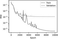
The training process for this novel method is exceptionally efficient; as noted by the authors, "The training process is rapid and only requires recorded samples from a single survey extent." This efficiency is achieved by training the CMLP networks on an Intel i9-10900KF workstation utilizing an Nvidia RTX 3090 GPU, optimizing the learning of potential fields across various geological contexts.
During the experiments, researchers employed synthetic and real-world datasets, notably the Wolfe Creek meteorite impact crater survey, to validate their model. The results from their synthetic case study featured a forward modelled grid that demonstrated the network's capability in recreating complex geological features with high fidelity.
The synthetic data case study, which spanned a region of 4 km by 4 km, illustrated how the model extracted a robust representation of the magnetic response even when challenged by the complexities of geological formation. This rigorous testing concluded with the proposed method yielding an RMSE of 10.30 nT for the synthetic model, affirming the search for more efficient computational methods in geoscience.
Furthermore, the application of automatic differentiation (AD) within the network architecture allows for a precise calculation of gradients. As described by the authors, "Spatial gradients can be calculated directly from the learned representation, and can be queried at arbitrary coordinates." This feature enables the generation of gradients prior to spatial evaluations, enhancing data interpretation and usability.
However, despite the method's advancements, the performance of vertical gradient calculations remains limited. Ongoing research aims to reduce this discrepancy by enhancing the model’s learning capacity through further development of the network’s structure and data incorporation techniques.
The Wolfe Creek case study, which included 402 line-kilometers of data, validated the network's performance against traditional grid methods, highlighting both the robustness and potential downsides of the new methodology. Researchers noted that specific high-frequency features, such as the crater rim, were less accurately modeled compared to broader geological structures.
As the field of implicit neural representation evolves, the implications for geophysical applications are vast. The ability to efficiently process and accurately represent large datasets could lead to advancements in mineral exploration, allowing for more effective resource management and environmental assessments.
In conclusion, the potential applications of INR with CMLP networks in geophysics signal a paradigm shift toward more accurate and efficient methods for subsurface exploration. The ongoing development aims to refine the vertical representation of potential fields further, promising a future where geophysical survey methodologies can maximize data utilization effectively.