The ocean may seem expansive and incomprehensible, but recent strides in satellite technology are significantly enhancing our understanding of its features. The SWOT (Surface Water and Ocean Topography) satellite, a collaboration between NASA and the French space agency CNES, has created one of the most detailed maps of the ocean floor to date. Launched in December 2022, the satellite provides valuable data that could change everything we know about underwater navigation and oceanic ecosystems.
Currently, only about 25% of the ocean floor has been directly surveyed using ships equipped with sonar instruments. This gap underscores why the work being done by the SWOT mission is so essential. According to Nadya Vinogradova Shiffer, head of physical oceanography programs at NASA Headquarters, "Seafloor mapping is key in both established and emerging economic opportunities, including rare-mineral seabed mining, optimizing shipping routes, hazard detection, and seabed warfare operations."
Understanding the ocean’s features is not just beneficial for navigation. Accurate mapping can improve our grasp of deep-sea currents and tides that affect marine life and geological processes like plate tectonics. For example, underwater mountains termed seamounts and their smaller counterparts, abyssal hills, play critical roles in nutrient movement and marine biodiversity. The latest SWOT-based seafloor map was published in the journal Science in December 2024, marking a pivotal moment in oceanographic research.
SWOT’s capability to measure gravitational anomalies from underwater features allows it to create detailed maps of the ocean's topography. David Sandwell, a geophysicist at the Scripps Institution of Oceanography, stated, "The SWOT satellite was a huge jump in our ability to map the seafloor." This advancement stems from the satellite's ability to cover 90% of the globe every 21 days, recording minute differences in sea surface height that correspond to the features below.
For instance, previous ocean-observing satellites were only able to detect massive seamounts rising over 3,300 feet (1 kilometer). With SWOT, researchers can now identify seamounts less than half that height, which may double the previously known total of underwater mountains from 44,000 to 100,000. This significant increase in the number of known underwater features is set to improve ecological research tremendously.
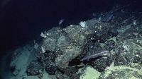
The ocean floor is not just a barren wasteland; it is a hotspot for life, particularly around features like seamounts. Current findings suggest that these underwater mountains can concentrate nutrients along their slopes, creating biological oases in otherwise desolate environments. This phenomenon is crucial for understanding marine ecosystems and could have wider implications for ocean health as a whole.
In addition to uncovering new seamounts, SWOT also sheds light on a pervasive geological feature—the abyssal hills. Described by oceanographer Yao Yu as the most abundant landform on Earth, abyssal hills cover about 70% of the ocean floor and are instrumental in understanding tectonic plate movements. According to Yu, "These hills are only a few kilometers wide, which makes them hard to observe from space. We were surprised that SWOT could see them so well."
Abyssal hills form in parallel bands where tectonic plates spread apart. Their orientation and extent can provide insight into how these plates have shifted over time. The study of these features reveals rich geological histories and has the potential to refine our understanding of oceanic dynamics, though much about their interactions with tides and deep ocean currents remains unknown.
The endeavors toward a comprehensive map of the seafloor resonate with the broader goals established within the international scientific community. Scientists have ambitiously set a target to map the entire seafloor using ship-based sonar by 2030. While it is unlikely that full mapping through direct surveys will be completed by that deadline, SWOT’s contributions are expected to fill in significant gaps, moving researchers closer to achieving this objective.
In summary, the SWOT mission is reshaping our understanding of the ocean floor and its critical features. Through innovative satellite technology, we are unlocking secrets that could not only enhance our navigation and operational capabilities but also foster a greater appreciation for the complexities of marine ecosystems. More information about SWOT can be accessed through NASA’s Jet Propulsion Laboratory, which leads the project’s U.S. component.


