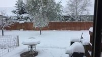
Montana is bracing for another significant snowstorm, with the National Weather Service issuing a winter storm warning for southwest Montana. The warning is set to be in effect from 6:00 p.m. on Monday, March 31, 2025, through 6:00 a.m. on Wednesday, April 2, 2025. Predictions indicate that the region could see total snow accumulations ranging from 4 to 10 inches, with heavier snow expected at higher elevations and mountain passes.
The winter storm warning specifically targets Gallatin County, where the greatest snowfall totals are anticipated in the southeastern end of the Gallatin Valley, including Bozeman. The storm is expected to create hazardous conditions for travelers, especially during the Tuesday and Wednesday morning commutes. Scattered rain showers are predicted for Monday afternoon and evening, transitioning to snow as temperatures drop later that night.
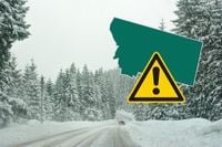
Travelers are advised to prepare for rapidly changing weather and road conditions. Those commuting to work should plan to leave early and allow extra time to reach their destinations. Keeping an emergency travel kit in vehicles is also recommended. For the latest updates on road conditions and closures, individuals can call 5-1-1 or visit the Montana Road Report website.
As the storm passes, temperatures are expected to rise again, with highs in the 60s forecasted for the following week. This fluctuation highlights the unpredictable nature of Montana’s spring weather, where winter storms can quickly give way to warmer conditions.
In addition to the winter storm warning, several winter weather advisories are in place across the region. These advisories indicate that lower elevations may experience 2 to 4 inches of snow, while mountain passes could see between 5 to 10 inches. The advisories extend to various locations, including the Bitterroot/Sapphire Mountains and the Potomac/Seeley Lake Region.
For the Bitterroot/Sapphire Mountains, the winter weather advisory is effective from 6 PM on March 31, 2025, through noon on April 1, 2025, with expected snow accumulations between 2 and 6 inches. Meanwhile, the Potomac/Seeley Lake Region is under an advisory from 6 PM on March 31 through midnight on April 1, with projected totals of 1 to 2 inches at lower elevations and 5 to 10 inches in the mountains. Higher elevations of the Mission Mountains could receive over a foot of snow.
As the storm progresses, isolated thunderstorms could develop south of I-90, particularly as instability in the atmosphere increases during the afternoon. High temperatures are expected to reach the 40s and low 50s, with overnight lows dipping into the 20s and 30s. The threat of showers will persist through Wednesday, April 2, as moisture from the storm continues to wrap around the area.
Snow levels are projected to drop to valley floors by Tuesday morning. However, thanks to warm road temperatures, impacts on lower elevation roads are expected to be limited. The forecast suggests that while the Gallatin Valley may receive significant snowfall, the exact amounts remain uncertain, with possibilities ranging from less than 2 inches to more than 12 inches depending on how much rain mixes with the snow.
In summary, residents and travelers in southwest Montana should prepare for a potentially disruptive winter storm that could affect travel and daily activities. With multiple winter storm warnings and advisories in effect, the region is on high alert for snow accumulation and hazardous driving conditions.