As commuters across Germany navigate their daily routes, a common challenge persists: traffic congestion fueled by new construction sites, accidents, and overloaded roads. From Celle to Remscheid, Nienburg to Brandenburg an der Havel, and Gifhorn to Gelnhausen, drivers face a patchwork of delays that highlight the complexities of maintaining and upgrading vital transport arteries.
In Celle and its surrounding region, traffic snarls have become a familiar frustration. Key roads like the Bundesstraße 3 (B3) heading south toward Hannover and north toward Soltau, Bundesstraße 214 (B214) toward Braunschweig and Schwarmstedt, and Bundesstraße 191 (B191) toward Uelzen are experiencing significant slowdowns. The Wilhelm-Heinichen-Ring in Celle is particularly affected due to ongoing construction, prompting officials to advise drivers to seek alternate routes. These updates come courtesy of the CZ-Staumelder, which aggregates data to keep residents informed.
Similarly, in Nienburg city and district, congestion is mounting on major highways and federal roads. The A2, A37, A7, A27, and A1 motorways, along with Bundesstraßen such as B6, B215, B214, B482, B62, B239, B51, B442, and B441, are all spots where drivers should expect delays. The HARKE Staumelder provides real-time information about these bottlenecks, helping travelers plan their journeys with greater awareness.
Moving to Gelnhausen and the Main-Kinzig-Kreis (MKK) near Frankfurt, the traffic picture remains challenging. The A3, A45, and A66 Autobahns, alongside Bundesstraßen B8, B43, B45, B276, B457, and B521, are experiencing slowdowns due to a combination of construction projects and accidents. The GNZ-Staumelder serves as a vital tool for locals, delivering updates every five minutes to ensure drivers can adapt to changing conditions.
Brandenburg an der Havel is no exception to these traffic woes. The A2 motorway toward Magdeburg in the southwest, Bundesstraße 1 (B1) running through the city toward Potsdam, and Bundesstraße 102 (B102) connecting Rathenow in the north and Bad Belzig in the south are all hotspots for congestion. Within the city, key routes like Potsdamer Straße—the bridge into the city—and Ziesarer Landstraße, an alternative route when the A2 is blocked, are under particular strain. The MAZ-Staumelder continuously updates these conditions, offering timely alerts to commuters.
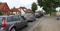
In North Rhine-Westphalia, Remscheid and its neighboring towns of Wermelskirchen, Solingen, and Wuppertal face some of the most severe traffic challenges in the country. The A1 and A46 motorways are among the most congested routes, with the A1 section between Cologne and Dortmund clocking nearly 6,500 hours of traffic jams in 2023 alone. The A46, connecting Düsseldorf and Wuppertal, ranks as the sixth most congested motorway in the state and serves as a critical corridor for Remscheid residents commuting to Düsseldorf and beyond.
Major federal and state roads compound the issue. The B229 cuts through Radevormwald and Remscheid, linking the region eastward to Sauerland and westward through Müngsten to Solingen. The B237 connects Wipperfürth, Hückeswagen, and Bergisch Born in Remscheid, serving many commuters near the Gewerbegebiet Am Eichholz industrial area. The B51 and its newer stretch B51n traverse the region from the A1 Burscheid exit to the Trecknase junction in Remscheid. State roads like the L74, known locally as "Kohlfurth," link Müngsten to the Wuppertal-Sonnborn motorway interchange, while the B483 connects Hückeswagen, Radevormwald, and extends north to Schwelm. In Wermelskirchen and Burscheid, the L101 runs from Altenberg through Dabringhausen toward Hückeswagen, with frequent jams near the A1 Kaltenherberg exits.
The ongoing reconstruction of the Wuppertal-Nord motorway interchange is a massive infrastructure project expected to span the next decade, promising long-term relief but also contributing to current traffic disruptions. The RGA-Staumelder diligently monitors these developments, providing up-to-date traffic information to help drivers navigate the region's complex road network.
Meanwhile, in Gifhorn and its environs, traffic congestion is notable on the A2 and A39 Autobahns, as well as Bundesstraßen B188, B4, B214, B248, and the K114. The AZ-Staumelder compiles data from multiple sources to offer drivers timely insights into traffic slowdowns caused by construction, accidents, and other obstructions.
Across all these regions, the common thread is the reliance on data from TomTom, a leading provider of navigation systems. TomTom harnesses GPS coordinates from millions of devices, automatic inputs from approximately 80 million mobile phones, millions of official road sensors, and manually maintained information to ensure accuracy. This data is refreshed every five minutes, enabling real-time traffic updates that are crucial for drivers planning their routes.
Other popular traffic information providers mentioned include Google Maps, Apple Maps, and Garmin, each offering navigation and traffic services that complement TomTom's data. Despite the variety of platforms, the emphasis remains on providing accurate, up-to-the-minute information to reduce travel times and improve safety.
Authorities and traffic services consistently remind drivers to exercise patience and consideration on the roads. With construction projects essential for maintaining and upgrading infrastructure, temporary inconveniences are inevitable. Yet, by staying informed and adapting travel plans accordingly, commuters can mitigate some of the frustration that comes with traffic delays.
Whether it’s the bottlenecks on the Bundesstraße 3 in Celle, the sprawling network of congested motorways in North Rhine-Westphalia, or the city streets of Brandenburg an der Havel, these traffic updates underscore the ongoing balancing act between infrastructure development and daily mobility. The digital tools available today, powered by extensive data collection and rapid updates, offer a beacon of hope for smoother journeys amid the inevitable challenges of road maintenance and urban growth.