A magnitude 3.1 earthquake was felt on March 24, 2025, in Silos, a municipality located in the Norte de Santander department of Colombia. According to the Colombian Geological Service (SGC), the earthquake struck at precisely 5:58 PM (local time) and had a considerable depth of 624 kilometers, with specific coordinates of latitude 7.152672768 and longitude -72.81652832.
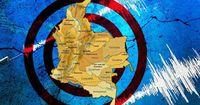
This seismic event is part of a pattern in Colombia, which resides in the Pacific Ring of Fire—a region known for its seismic activity, containing 75% of the world’s volcanoes and experiencing approximately 80% of the strongest earthquakes globally. As such, Colombia is recognized as a country of high seismic risk, particularly in departments like Nariño, Chocó, Caldas, and Santander, which are identified as the most seismic areas in the nation.
Silos falls within a region recognized for its seismic frequency, especially Los Santos municipality in Santander, which is considered the second most seismic zone in the world. The SGC noted that the information regarding the earthquake is preliminary and may be subject to changes or updates regarding its magnitude and the exact location of origin.
Understanding the impact of earthquakes in Colombia involves knowledge of the European Macroseismic Scale (EMS-98), which is used to classify the intensity of seismic events. For instance, an intensity level of 3 is categorized as “felt slightly,” where only a few people at rest may notice motion. When the intensity reaches level 4, it means the tremor is “widely felt” by many in buildings with some objects vibrating, and at intensity level 5, it’s described as “strongly felt,” leading to small objects being displaced and potentially minor structural cracks.
Strikingly, levels above 7 indicate “severe damage,” where many individuals encounter difficulties standing, heavy objects fall, and aged structures might collapse. Given Colombia's geological characteristics, seismic events have historically ranged from mild to disastrous, impacting communities and environments drastically.
Colombia's geographical situation contributes to its high seismicity. It sits on the Nazca and South American tectonic plates, with the former also interacting with the Caribbean Plate. These collisions frequently produce earthquakes, making certain regions particularly vulnerable to seismic events.
Historically, several catastrophic earthquakes have hit Colombia, marking significant dates in its seismic history. The worst recorded earthquake occurred on January 25, 1999, affecting the Quindío and Risaralda departments. This disaster registered a magnitude of 6.2, claimed over a thousand lives, injured four thousand more, and left a substantial number of people missing. Economic losses were severe, with coffee farms and industry structures heavily impacted.
In addition to the devastating quake in Quindío, earlier events have also marked Colombia's seismic narrative. For example, the earthquake on May 18, 1875, known as the “Earthquake of Los Andes,” had a magnitude potentially reaching up to 8.5, resulting in over 460 known casualties, though estimates suggest many more might have perished.
Two significant quakes in 1868 near the Colombia-Ecuador border recorded magnitudes of 6.3 and 6.7, with the latter leading to extensive devastation, particularly in Ecuador's Ibarra region, with casualty estimates soaring to around 70,000 people.
One particularly notable event occurred on January 31, 1906, when an earthquake of magnitude 8.8 struck Esmeraldas in Ecuador, leading to a tsunami that resulted in 1,500 fatalities and significant flooding in the Colombian coastal town of Tumaco.
Seismic awareness is a crucial topic in Colombia, especially given the country's historical challenges with earthquakes. As a result, preparedness and education about seismic risks have become increasingly essential, ensuring communities are informed and able to respond effectively to potential tremors.
As the SGC continues to monitor seismic activity and provide updates, residents in high-risk areas are encouraged to remain vigilant and prepared for potential earthquakes. While most tremors may go unnoticed or result in minor disturbances, Colombia's location necessitates a constant awareness of the potential for severe seismic events and the damage they can cause.
The recent earthquake serves as a reminder of Colombia's geological realities, compelling inhabitants to acknowledge their environment's unpredictable nature. With seismic history spanning centuries, the need for continued education and awareness among the populace cannot be overstated; each tremor underscores the importance of preparedness in a nation living under the shadows of its tectonic dynamics.