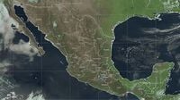
As the cold front number 38 sweeps across Mexico, the Servicio Meteorológico Nacional (SMN) has issued warnings for severe weather conditions that are expected to affect various regions of the country. This cold front, which began moving over the north and northeast of Mexico on April 11, 2025, is bringing with it a mass of cold air that has already resulted in significant drops in temperatures, particularly in mountainous areas.
On the morning of April 12, temperatures are anticipated to plummet to below zero, with forecasts suggesting that areas in Durango and Chihuahua could experience lows of -15 °C. The cold air mass will create a frigid environment, especially in high-altitude regions, where frost is likely. The SMN has highlighted that these conditions will persist through the weekend, with temperatures remaining low in the north, northeast, center, and east of the country.
In addition to the cold temperatures, the front is expected to bring strong winds. Gusts reaching up to 90 km/h are forecasted in the Isthmus and Gulf of Tehuantepec, which could lead to hazardous conditions, including dust storms in states like Chihuahua, Durango, and Coahuila. The winds will be accompanied by a notable risk of forest fires in areas such as Sinaloa, Nayarit, and Veracruz, due to the dry conditions and high wind speeds.
While the northern regions brace for the chill, the southern states are facing a different scenario. The combination of low-pressure channels and humidity from the Pacific Ocean and Gulf of Mexico is expected to cause showers in Oaxaca and Chiapas, along with isolated rains in Guerrero, Veracruz, and Tabasco. This contrast in weather highlights the diverse climatic conditions that Mexico experiences simultaneously.
As the cold front moves swiftly over the center and east of the Gulf of Mexico, it is predicted to cease affecting the national territory by April 13. However, the cold air mass associated with the front will linger, maintaining cold conditions during the mornings and nights. The SMN advises residents to prepare for possible frosts at dawn in the affected regions.
In the Mexico Valley, known for its unpredictable weather, residents can expect a significant drop in temperatures as well. The forecast for April 12 indicates that temperatures will range between 8 and 10 °C in the early morning, rising to a maximum of 25 to 27 °C during the day, under clear skies. Winds of 30 to 50 km/h are also expected, which could lead to dust storms.
In the northern states, particularly Durango and Chihuahua, the cold front's impact will be felt most acutely, with temperatures dropping to as low as -15 °C in mountainous areas. The SMN has warned that these conditions could pose risks to vulnerable populations, especially the elderly and those without adequate heating.
As the country grapples with these extreme weather conditions, the SMN continues to monitor the situation closely, providing updates and safety recommendations to the public. The agency emphasizes the importance of staying informed about weather changes and taking necessary precautions to ensure safety during this cold spell.
Looking ahead, the SMN has indicated that a new frontal system is approaching the northwestern border of the country, which could introduce additional weather challenges in the coming days. Meanwhile, a subtropical jet stream is expected to cause strong winds with potential dust storms across the northern and central regions.
In summary, cold front number 38 is bringing a mix of severe weather across Mexico, with frigid temperatures, strong winds, and varying precipitation patterns. As the country prepares for these conditions, residents are urged to stay alert and take necessary precautions to safeguard their health and property.