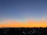
The autumn of 2025 began on Thursday, March 20, at 6:01 AM and will last until 11:42 PM on June 20, marking a crucial transition for many regions of Brazil. This season is characterized by the shift from the typically wet period to a drier phase, which heralds the beginning of winter across most parts of the country.
As temperatures cool and rainfall patterns shift, citizens may notice a significant decline in precipitation frequency and volume. This pattern is largely driven by the increased presence of atmospheric high pressure systems over Brazil's interior, which naturally reduces humidity levels and alters weather dynamics. According to meteorological reports, even though it might start warm as the stored heat from summer lingers, the temperature is expected to gradually drop as we move deeper into fall.
In the northeastern coastline, however, autumn assumes a different character; it is expected to be the rainiest period of the year in cities like Salvador, Recife, and João Pessoa. In contrast, certain northern areas of Brazil, including Roraima and Amapá, will still experience frequent rains at the beginning of autumn, before witnessing a gradual decrease by the season's end.
Among the changes accompanying the autumn season is the development of cold fronts, which frequently move through the southern and southeastern coasts of Brazil. These cold fronts tend to become more intense over time, bringing with them a heightened potential for lower temperatures. As some cold air masses push into the interior regions, significant temperature drops may occur, particularly in the center-west of Brazil and parts of northern regions where a phenomenon locally known as friagem can be expected.
The Intertropical Convergence Zone (ZCIT) will continue to exert its influence on northern Brazil during the first half of autumn, though its impact is expected to decrease as the season progresses. The growth of the South Atlantic Subtropical High (ASAS) will further decrease humidity, creating cool and pleasant nights due to air subsidence. Instances of fog and frost are predicted to become more common as nightly cooling intensifies.
This particular autumn will experience a condition of thermal neutrality in the equatorial Pacific Ocean, located off the Peruvian coast. This neutral phase suggests that neither El Niño nor La Niña patterns will significantly affect Brazil's climate. While a coastal El Niño might develop, its potential impact is considered minimal on the overall climatological patterns within the country.
The Climatempo forecast indicates that during autumn 2025, rainfall will likely remain around or slightly below average in states like Paraná and across the Southeast and Midwest regions. However, in areas such as Santa Catarina and Rio Grande do Sul, rainfall amounts could exceed average levels. Most of the northeastern states are predicted to experience normal seasonal rainfall, while coastal areas of Maranhão and Piauí anticipate slightly higher precipitation levels than normal.
In northern Brazil, the trend suggests that rainfall will also stay slightly below averages, with Amapá and regions around Ilha do Marajó expected to receive above-average rainfall this autumn.
Temperature trends indicate a near-normal autumn for Rio Grande do Sul, while Santa Catarina is expected to witness marginally higher than average temperatures, and Paraná forecasted to experience temperatures that are somewhat above normal. The Southeastern and Central-Western regions are also anticipated to see higher temperature averages as the season unfolds. In the North and much of the Northeast, temperatures should remain around normal to slightly elevated, with western Bahia projected to experience especially high temperatures.
Despite the optimistic forecasts of higher temperatures across Brazil, the onset of autumn will not be devoid of chill. The first significant cold front is likely to arrive in mid-April, potentially bringing hefty temperature drops to the central and southern regions of the country. This event is expected to herald the full arrival of autumn vibes.