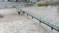
A low-pressure system originating from the Atlantic is set to bring colder temperatures and unstable weather across Spain on Friday, May 2, 2025, with widespread rain and storms expected. According to the State Meteorological Agency (AEMET), this weather pattern will particularly affect the interior of the peninsula, with rainfall moving from the southwest to the northwest. A yellow alert has been activated in 13 autonomous communities due to the anticipated heavy precipitation, with some regions facing even more severe warnings.
In Andalusia, Castilla y León, and Extremadura, alerts are in effect throughout the day, while regions such as Aragon, Asturias, Cantabria, Galicia, and the Valencian Community will see alerts begin in the afternoon. Heavy rain began in Castilla-La Mancha early in the morning, while Ceuta experienced a cessation of rain by 6:00 AM.
Madrid was particularly impacted, experiencing a night of heavy rain and hail, which led to significant concerns for residents. AEMET has issued a yellow alert for parts of Zaragoza and Teruel in Aragon, predicting heavy rain and storms from noon until midnight on May 2, with rainfall potentially reaching 15 liters per square meter within an hour in the western half of the Ribera del Ebro and up to 20 liters in other areas.
Storms are expected to accompany the rainfall, with larger hail anticipated in Teruel. The intensity of the weather is expected to result in significant rainfall accumulation, especially in the northern regions, including the Cantabrian area and parts of Castilla y León, where up to 40 liters per square meter could fall within 12 hours.
In areas like León, Segovia, and Ávila, temperatures are not expected to exceed 20 degrees Celsius, while Extremadura and other interior regions will see maximums ranging from 20 to 25 degrees. In contrast, the Mediterranean region, including Palma, is likely to exceed 25 degrees, with Alicante and Albacete reaching up to 26 degrees.
As the weekend approaches, unstable conditions are expected to persist. On Saturday, May 3, 2025, the influence of another Atlantic storm will bring increased cloud cover and precipitation to the western half and the interior of the eastern third, along with the Balearic Islands. Regions such as Asturias, Castilla-La Mancha, Comunidad Valenciana, and Murcia will maintain yellow alerts from morning until nearly midnight.
Moreover, the Regional Government of Castilla-La Mancha activated the Specific Plan against the Risk of Adverse Meteorological Phenomena (Meteocam) at 9:25 AM on May 2, due to orange-level warnings for storms in Guadalajara and surrounding areas. This plan aims to prepare local municipalities for potential flooding and other storm-related incidents.
Citizens have been advised to take precautions during the severe weather. Those on the road are urged to reduce speed and avoid flooded areas, while residents are reminded to secure outdoor items that could be swept away by flooding. If flooding occurs in their homes, they should abandon lower levels and disconnect electrical appliances.
The Basque Government's Department of Security has also activated a yellow warning for heavy rainfall in the region, predicting that rainfall could exceed 15 liters per square meter in one hour, particularly in the southern areas. Strong gusts of wind have already been reported, with the highest gusts reaching 101 kilometers per hour on Mount Zaldiaran in Gasteiz.
In Galicia, the storms have already caused numerous incidents, including flooded basements and fallen trees, as reported by the emergency services. The AEMET has indicated that the storms will continue throughout the weekend, albeit with less intensity, with further rainfall expected on Sunday, May 4, 2025, particularly in Galicia, Cantabria, and the Pyrenees.
As the situation develops, AEMET continues to monitor conditions closely, providing updates and alerts to ensure public safety during this period of significant meteorological activity. With the May holiday weekend approaching, many are reminded to stay informed and prepared for the unpredictable weather ahead.


